Friday, 13 April 2012

Kaikoura to Picton

Leaving Christchurch we made our way up the East Coast stopping overnight at a nice campsite on the beach.  The following morning was good Friday and the locals were all out on the road either escaping for the long Easter weekend or simply taking the vintage sports cars out for a spin.  We however were trundling along at not too speedy 90-100kph (100kph is the speed limit - of which we can only just about break with the sheer power of momentum and a nice long downward hill).  Hence there was a nice bit of friendly horn tooting on the Highway 6 that day.  Wanting to get off the main road for a bit we took a detour over to a nice little place called Gore Bay.  Gore Bay is home to some interesting rock formations known as the Cathedral Cliffs due to the organ pipe structure that has been created over thousands of years.


Heading further up the coast we were straddled between the pacific on one side and the rail line on the other for near 100km.  Weaving through a multitude of tunnels and following the road around the cliff edges was good fun, but would certainly have been a lot more fun in one of those convertible vintage sports cars that kept tooting away.  We soon arrived at the small peninsular town of Kaikoura.  The Pacific Ocean here drops sharply to nearly 100m not far from the shore and again to nearly a 1km deep a short distance out.  This makes for a varying spectrum of ocean blues as well as bringing a whole host of sealife close to the shores.


From town we took a long stroll around the Kaikoura peninsular taking in an ever changing environment from sandy beaches to woodland, and farmland to seal colonies.  It was probably the latter that was of the most interest however.  The seal colony was right there on the end of the peninsular and many of the seals had ventured up on to the land for some Easter holiday sunbathing action.  This meant that you could get pretty close, within 2 meters if you dared.  You could definitely get close enough to smell them!  The rest of the walk took us to the very end of the peninsular and some steep cliff edges that felt like the end of the world.  Looking out and knowing that there is nothing in that direction (ignoring perhaps Easter Island) for several thousand kilometers until you reach Patagonian Chile is a very cool feeling.


That evening we headed further north still and found a nice camping spot again alongside the beach but just the other side of the rail tracks (luckily the trains only go two or three times a day) at Okiwi Bay.  The following morning we did a small hike again, up to the top of cliff for the 'Pacific Lookout'.  It was much more strenous in the sun than we thought it would be but once we got to the top the views more than made up for it.  Theres a great lookout across the Ocean and from that height (550m) you can really see the Pacific shelfs drop as the blues of the ocean darkern.


Further up the coast we arrived at our third beachside campsite in as many days.  It was on the pleasant Marfells Beach, it was however absolutely overrun with Kiwi's out enjoying the warm autumn Easter weekend before the onset of winter kicks in.  This being Easter Sunday and being located far from family and friends for another holiday season we tucked into some hot cross buns, but alas no Easter egg hunt, maybe we're told old for that anyway.  That morning we made for the small port town of Picton.  This was our entry point to the South Island via the ferry some 18 days ago.  We saw very little of Picton and the Marlborough Sound other than what we saw from the ferry last time so decided to allow out it a little more this time around.  There's the supposedly stunning four day Queen Charlotte track which you can do through the Sound, but with just an afternoon to spare we opted instead for a shorter walk to the end of the picton snout which offers great views of the Marlborough Sound.  The sun was shining again, in fact since slating the weather on the West Coast we have been basking in autumn sun for the last dozen days.  The view from the end of the walk was stunning and being the Easter Sunday those that had them were certainly taking advantage in their boats, as looking down from above the water was littered with them.


Picton brings an end to our South Island journeys as we take the ferry at 8.00am the following morning and start our 600km three day race back up to Auckland.

Tuesday, 10 April 2012

Christchurch, Marv and the TranzAlpine

Early in the morning we set of from Arundel just north of Geraldine and made our way steadily North by North East almost in parrallel with the South Islands elongated shape along the 'inland scenic route'.  Unfortunately for us we had perhaps set off a bit too early (it was only 9.30am) as we spent a good three quarters of an hour driving through fog.  A lot of whites and greys on the scenic route but not much else.  After about an hour we broke through the fog and found ourselves out in the open of the 'Canterbury Plains'.  New Zealands flattest and most expansive area of farmland.

Just before midday and about a thousand sheep later we arrived on the road into Christchurch.  Due to the occasional 'problems' Marv had been giving us (even after a mechanical check at the Fox Village) we had with a heavy heart decided to swap Marvin at the Christchurch depot for another and different van, Marv Mk II.  We didn't want to be unable to start the van and miss our ferry back to the North Island, or worse still miss our onward flight to Fiji in little over a week.  We said our goodbyes to Marvin and swapped all our gear into Marv Mk II.  Marv II is a Ford Econovan as well but the Australian version, looking pretty similiar from the outside , but coming with a slightly different layout inside and a worrying lack of power steering.  Marv II has the turning circle of a battleship and drives like a tank.

After testing out the new van on the road we arrived at our holiday park in Christchurch.  We soon realised however that this new van had a bit of a technical plumbing malfunction.  Whenever we used the kitchen sink  a good proportion of the water would slowly but constantly seap out from the underneath and onto the floor.  Not good.  Not wanting to waste any time going out to the depot and back we headed down to the local warehouse store to get a replacement part and some duct tape.  Before to long however it was too dark to see and we gave up on our efforts for the day.

The following day marked a much more memorable day for us, April 4th 2012.  Exactly six months since we set off from London in October last year, and the potential half way point in our journey.  To mark this day we took the TranzAlpine Kiwi Rail from Christchurch across country to the West Coast and back again in a day.  Its a single track so the same train that departs in the morning for the West Coast, departs in the afternoon to come back to the Pacific Coast covering nearly 400km.  The TranzAlpine is billed as New Zealands most prestigous scenic train ride, and is often ranked as one of the Top 10 rail journies on the planet.  Thats a lot of hype to live up to.


Setting off early that morning, the train departed from Christchurch at 8.15am and with several long blasts of the horn we set off through the Canterbury Plains.  Passing through the farmland we then wound our way through the hills and alongside the lakes of the Upper Central South Island before arriving at the foot of the Southern Alps.  From here we made our way in and out of around a dozen brief tunnels and several long viaducts before climbing 700m up to Arthurs Pass.  After a brief stop here we soon made our way down through the lush green vegetation of the West Coast.  Passing through a 7.5km (rather unscenic) tunnel which at time of construction was the longest rail tunnel in the British Empire and the Southern Hemisphere.


Around 12.45pm, four and a half hours after leaving Christchurch we arrived at Greymouth on the West Coast.  The sun was shining and the skies were a brilliant blue, and we had around an hour for lunch alongside the river before we needed to board for the return journey.  Greymouth is a town we passed through fleetingly on our second day in the South Island where we stopped only to refuel and visit the supermarket.  We spent no time longer here than we did then but it felt strangely nice to return to a briefly familiar place after several weeks.


Just before 2pm we set off again for the trip back to Christchurch.  Travelling the other way, sitting on the otherside of the carriage and under a different light it was like doing a different journey.  If it wasn't for the same snippets of factual commentary from the conducter it could well of been.  Alas we made our way back up the Southern Alps, through Arthurs Pass and the Canterbury Plains before arriving back to Christchurch around 6pm.  It was good to see two perspectives and we had a great day with some stunning scenery, it would however be ideal to see it in two seasons.  The blue skies that we had were majestic but its not difficult to imagine the grandeur of the journey on a cold fresh snow covered morning.


Back in Christchurch and back to reality... the following morning it was apparent that we had been unable to fix the water 'issue' and to make matters worse the primary battery for the engine had somehow gone flat.  Luckily we were at the holiday camp and could get Marv II jump started, however it proved to be the final nail in the coffin.  A lack of power steering, leaking sink, an annoyingly different layout and now a flat battery.  Two days, two nights and only 15km on the clock and we were both crying out to be reunited with our beloved and original Marv.  Off to the depot we went, and fortunately Marv was still there.  The guy at the depot (which is essentially a field on the side of a guys house) sent our original Marv down to the mechanics for a check over and while we waited he showed us round the grounds of his house.  This guy, Bryan, has a large plot of land where he has all manner of fruit and nuts growing in orchards, a large pond, and of course a field of sheep (this is New Zealand after all).  When Marv came back from the garage he had been given the all clear, the problem which had become apparent was fixed (needless to say it was missed by the mechanic at Fox).  We set about moving our stuff back into Marvin and we're even given a big bag of walnuts and hazlenuts as well as some fresh apples before setting off.  The Marvelous Marv was back with us and back on the road.

This left us just the afternoon to have a good look around Christchurch, the South Islands biggest (possibly only real) city, and home to nearly half of all South Islanders.  Luckily the weather was holding up so we could have lunch in the park and a stroll through the stunning botanic gardens.  We also had a nose round the massive Canterbury Museum, of particular interest was all the history and detail of the devastating earthquake that hit in February 2011.  The broken bell and crucifix from the cathedral lie in the museum alongside alarming footage captured from civilians and security cameras.  Christchurch city centre is still a write-off with the central district still blocked off 14 months on while future planning takes place. In its place they have erected a pop up shopping centre made from shipping containers just south of the old city centre.  Walking around the edges of the Red Zone feels a little post-apolocalyptic as you can see through the wire fencing into a deserted and in parts crumbling city. 


Hopefully in the years to come Christchurch will redevelop its city centre, but the way in which they are recovering and the speed of the changes seems to be a controversial issue amongst the local population.
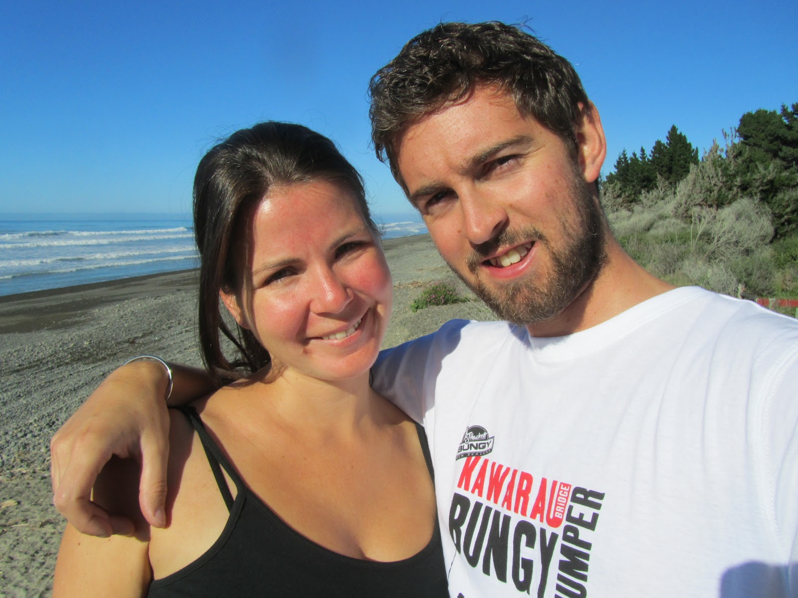
Monday, 9 April 2012

In search of Geraldine

Don't be fooled this blog entry is not about Geraldine Place, but the equally wonderful Geraldine THE Place.  Geraldine, in the heartland of the Canterbury Plains is the fresh fruit and produce capital of New Zealand.  We first however had to make our way north east several hundred kilometers from Queenstown.

Hoping to get a relatively early start on the road we were waylaid briefly as Marvin decided he like Queenstown so much he didn't want to leave.  After an hour or so we finally got Marv up and running and were on our way.  Once on the move we headed back past the Kawarua Bungee Bridge and through the town of Cromwell, apparently the town furthest from a coast in New Zealand.  We continued on our way through the Central Otago wine valley and vineyards to the top and over the otherside of the Lind Pass.


That afternoon we arrived at Lake Pukaki.  A huge brilliantly turquoise glacier-fed lake.  This route brough us up the east side of the Southern Alps and we were now the otherside of Mt Cook from when we had been at the Fox and Franz Josef Glaciers.  Evidently in the time we had been in the southern part of the island the freeze had started as 3,000m up on Mt Cook we could see a lot more snow than the week before.


We found a free campsite on the edge of the lake set amongst a pine forest which offered some fantastic views of the now heavily snow capped Mt Cook.  New Zealand prohibited 'Freedom Camping' in September 2011 due to waste products and inconsiderations of certain campers.  Freedom Camping is stopping overnight in a non campsite location if you are not self-contained, ie. no toilet on board.  We always stay in designated campsites, although these free ones often have just a long drop toilet and not much else!  These campsites or 'reserves' are often on the edge of a lake/river/beach, so often offer some great views.  Due to the banning of the Freedom Camping, district councils are putting more free campsites in place, but you need to look for them or ask at the local visitors centre or you might never find them.


The clocks have just rolled back an hour for Autumn so we woken nice and early by the early bright sunshine.  Daylight hours are around 7am-7pm now, with it being pitch black by 7.15pm.  This means its a tad easier getting up in the morning (although still cold) but means we ideally need to be located by 6.30pm to make sure we're not driving around aimlessly in the dark of an evening.  So woken by a new Autumn sun that morning we dragged ourselves away from the lake and the morning views of Mt Cook.... the evening views were better anyway.  We carried on up the road till we arrived at our next brief stop, Lake Tekapo.  A lake of a similiar vain to the previous with a shimmering turquoise colour.  What puts this lake on the map is its small chapel, 'The Church of the Good Shepherd'.  The chapel is on the southern shore of the lake and the window behind the altar opens out to stunning views of the lake and scenery behind.  At 700m above sea level the area around Lake Tekapo is billed as having the clearest air in the Southern Hemisphere.  It looks pretty clear during the day but a night you can really appreciate it as the sky is covered with stars and the milky way can be seen as clear anything.


From Lake Tekapo we made our way through the very small town of Fairlie, before arriving fairly quickly to Geraldine.  The locals here must have thought we were on some mad drugs or something as we ran around laughing and taking pictures of everything that said 'Geraldine'.  This ultimately was a lot;  the butchers, bakers, library, cinema, school even police station!  After the initial excitment had died down we had a look around and discovered to our (low budget) benefit that there were plenty of produce stores open for free tasters etc.  We headed first for Barkers for a whole host of jams, chutneys, pickles and juices before taking a stroll down the road to Geraldine cheese shop for a savoury treat.  Last on the list was a small store called Prenzel of Geraldine where we spent half hour talking to the shop owner about our travels around New Zealand and she told us all about her family who had most moved to Oz.  Prenzels had a great selection of sauces as well liquors (a bit early for), but we ended up buying just some cheese and walnut paste, but only after Adam had finished off nearly a whole jar of assorted pickles and chutneys.


We found another free campsite just outside of Geraldine on the edge of the small village of Arundel to spend the night.  The following morning was time to tackle the Route 72, the South Islands 'Inland Scenic Route' up to Christchurch.

Wednesday, 4 April 2012

Bungeee...

The Kawarau Bridge Bungee Jump in Queenstown.  If the embeded video doesn't work try the manual youtube link below....


Milford Sound

The hardest thing about this blog update is quite simply selecting just a choosen few photos to put on here from the three hundred plus taken in just a twelve hour period.

Milford Sound lies 100km West of Queenstown but is a good 600km horseshoe shaped round trip.  The top right of the horseshoe is Queenstown and Milford Sound lies at the top left on the Tasman coast.  The sprawling mass of the Southern Alps prohibits any more direct approach.  Rather than venturing all that way out there on our own we decided to do the day trip from Queenstown.

Setting off at 6.45am we got on the coach whilst it was still dark and very very cold.  The coach made its way around Lake Wakatipu and along the base of The Remarkables.  As the first signs of daylight were appearing we could start to see the outline of the dominating mountain range.  As the early morning wore on more and more light appeared but the visibility was often kept low by the fog.  At some stages it felt like travelling through a cloud, it was a welcome relief not to have the responsibility of driving on these roads.  The further we went the more the sun started to burn off the fog and the more we could see, although it was still feeling pretty nippy.  After a few hours we arrived at the pleasant lakeside town of Te Anau (bottom left of the horseshoe), we were about two thirds of the way there, but had the slowest third to go as we needed to go up and over the mountains and in one case straight through.

So far the scenery had been quite farmland based, (and i think a few people slept through it), but after our mid morning coffee break in Te Anau things were starting to heat up as we set off on the Milford Road.  After a short while we pulled up in a valley at the base of a small mountain range where the fog had all but burnt off leaving just a thin layer lining the base of the mountains.  Fog itself is often tainted as an annoyance, but in this instance it has never looked so good.  A little further down the road we arrived at the very aptly named 'Mirror Lakes' which gave some incredible views of the surrounding mountains and vegetation.  Our final stop before Milford Sound was The Chasm, a large waterfall that had blasted the rock in its way to create its own path through the forest leaving some very interestingly shaped rock formations in its wake.  The last stage of the coach journey was through the mountain as we headed through the Homer tunnel, a single lane 1.5km long gradient tunnel that had taken over 20 years of blasting through solid rock to create.  As its one-way and 1.5km in length you need to time your journey right otherwise you can be waiting up to ten minutes for the green light!


Shortly after midday we arrived at Milford Lodge, a quick comfort break and a chance to stretch the legs before we were whisked onto our cruise boat, The Lady Bowen, for a two and half hour cruise around the Sound.  The Sound itself is the result of a long retreated Glacier but it reaches all the way out the Tasman Sea so is actually full of salt water.  This coupled with the depth, often over 200m, makes a great retreat from the Ocean for sealife including Fur Seals and Dolphins, of the former we saw plenty but unfortunately no dolphins.  On the cruise we passed plenty of waterfalls, some of which are only present after several days of rain, and all manner of rock formations.  The Sound is such a vast expanse of space that you need the two hours to appreciate it fully.  The cliffs mainly rise vertically out of the water for half a kilometer or more, and what can look like a small waterfall on the otherside of the Sound can be the size of a 50 storey building when you get up close.  Its hard to describe in words (and to do justice) to the beauty of Milford Sound.  The feeling of euphoria due to the epic expanse of the openess of the perfectly still water combined with the conflicting constrictions of the mountains rising vertically from them is almost surreal at times.


 Weather conditions were good for us, in what can be a very pot luck location.  As the cruise wore on some of the bigger clouds dispersed and we had fantastic blue skies and sunshine emenating from behind the remaining scattered clouds.  With conditions good we were able to get out into the Tasman and view the entrance to the Sound from the Sea.  The same as Captain Cook would of done some 250 years previous, Cook however misinterpreted the entrance as just a small bay and Milford Sound remained hidden from European eyes for 100 years.


After a spot of lunch on the boat we headed back to our coach for a long trip back to Queenstown.  At the end of the day it felt like a long coach journey back, but still the views arriving back to Queenstown with the sun setting behind the mountains makes it feel like you've had a full day of sightseeing rather than just the coach being 'transportation'.


Due to time constraints and the distance to Milford Sound we were unsure at first if we were going to see it.  However choosing the day trip from Queenstown made it feasible and extremely enjoyable. We would definitely recommend to include Milford Sounds on the list for any visit to the South Island!

Monday, 2 April 2012

On the Road, Wanaka to Queenstown

We left the West Coast to head inland towards Queenstown. We made our way (slowly) up the Haast Pass, 562m above sea level, this sits about a third of the way up the South Island just a short way inland from the Coast.  After starting our descent from the pass we soon found ourselves straddling two beautiful lakes, Lake Wanaka and the Lake Hawea.  The sun was out in full effect and this made for some of the most picturesque driving we have done in our three weeks so far in New Zealand.  The lakes in the South Island are all formed from remnants of long ago glaciers (NZ was in an ice age just 12,000 years ago) so the waters are incredibly clear and shimmer in the sunlight.  With the surrounding mountains rising high at the lake edges it makes for some incredible scenery.


Not too far down the road we arrived at the town of Wanaka, situated at the bottom of the lake of the same name.  In Wanaka we decided to tackle the suitably named Puzzle World.  This included an outdoor three dimensional maze with over 1.5km of walkway, we must have covered about 5km though by the time we came out!  Inside they also had a whole array of puzzling rooms, from the Following Faces room to the balance loosing Tilted Room, and even a Leaning Tower of Wanaka outside, leaning at a crazy 54 degrees.  We spent the night just outside of town in a council campground, we thought we might get away with a free nights camp but were awoken in the early hours with a knock knock on the front window!


The following day we set off for Queenstown but faced a difficult choice.  To go round the mountain or over the mountain.  Going round the mountain would mean sticking to the highway but taking 110km.  Whereas going over the mountain on the Crown Range Pass meant some very steep and windy roads and most likely a lot of second gear crawling, but only 67km of road.  We choose the latter.  Opened in 2000 the Crown Range Pass is New Zealands highest tarmaced road some 1080m above sea level.  With some solid high rev low gear driving we just about made it to the top to appreciate the views before rolling down the otherside to Queenstown.


Queenstown sits on the stunningly clear Lake Wakatipu and is hemmed in by several mountain ranges including the well named 'Remarkables' range.  Queenstown takes its name from its founding when it was deemed to be a location 'fit for the Queen', and the Remarkables mountain range from the fact that they were viewed as 'quite remarkable'.  Queenstown is still quite a small town, the population is listed as less than 15,000 but it is the selfstyled activity hub of New Zealand.  There are over 200 different activities to try your hand at from the high octane; sky dive, bungee, rafting, to the more obscure frisbee golf.  That's nearly one for every working day of the year.  (Not that we know much about that anymore, we've pretty much lost track of days of the week now).  By day the skies over the Gondola are peppered with paragliders drifting over town.  Plenty to think about, and plenty to keep you occupied if you have the money.  However a relatively small town out of the young crowd you find everyone munching on a takeaway humongous Fergburger or with an activity number scribbled on their hand in permanent marker. We could definitely spy the above while lazing around on the grass listening to some live music at the Saturday market.


Queenstown also has some stunning gardens which edge out into the Lake Wakatipu on a small peninsular.  Its here that we can really start to feel the changing of the seasons, although its generally been warm and sunny during the daytime, when the suns not out and during the evening you can quickly feel the chill, and two pairs of socks is often a neccessity.  The leaves on the trees are starting to turn brown and some are already falling as Autumn takes hold, a season we should of been entering six months ago back in October when we left the UK for the Southern Hemisphere.  It feels like a good time to visit Queenstown as the large influx of tourists and campervans is on the decline but the weather is still on the nicer side.  However in such a setting its easy to imagine Queenstown as a stunning setting in every season.


The Wet Coast

We awoke our first morning in the South Island in a deserted DOC campground.  After a bite to eat we were back on the road and aiming for our next destination, the South Islands famed West Coast.

After some very deserted long and windy roads through some very foggy weather we arrived at the Tasman Sea.  Fortunately for us we had made our way out of the bad weather and found ourselves crusing along the coast road in the blazing sunshine.  Making our way south along the coast you could take your pick of the beauty spots for lunch, and we chose a cracker along a gorgeous stretch of uninhabited beach.  Before long we arrived at the small town of Punakaiki, home to the so called Pancake Rocks.  These rocks have been formed over millions of years, and have resulted in the most extreme form of sediment layering.  Hence their name as the Pancake Rocks.


The weather was still holding out pretty nicely by the time we arrived to our next camp ground,  but despite it being a nice enough evening it was a bit on the cold side for a dip in the lake.  We were however joined by some very inquisitive kiwiesque flightless birds who seemed very interesting in getting their beaks into our cuppa soup.  I guess everyone needs a great big hug in a mug.  We are feeling the cold in the South Island more and more, each hundred kilometers or so further we go the colder it gets after the sun has gone down.  Seasonwise Its the polar opposite to the UK, we are exactly 12 hours time difference, and right now we are fast approaching the middle of Autumn.


Expecting to wake up to more sunshine we were dissapointed by a downpour which was to last for around 24 hours.  We headed into the town of Hokitika, and hunting for some dry indoor activites (by this time the downpour was torrential) we happened upon the Jade Museum.  The town is famous for its Jade and Greenstone and gave us a good hour or so inside to see some live carving and wander the workshops.  With a break in the rain we decided to brave it and head further south towards the Franz Josef Glacier.  A short 50km drive took forever as we had to pull over several times as the level of rain coming down was so horrendous, and the lowlying fog meant you couldn't see to the end of the one-lane bridges to give way even if you wanted to.  These one-lane bridges are everywhere in this part of New Zealand, we did 20 in one morning, whats wrong with a good old two lane bridge.

The following day we saw the Franz Josef Glacier.  A short 30 minute walk from the town brings you to the face of the glacier.  The glacier offered nothing of the grandeur or splendour of the glaciers we saw in South America but they made for a good day out all the same.  Here we had our first mechanical trouble as Marv decided he had had enough, but (fortunately) we were parked in the visitors centre car park so we weren't stranded in the middle of nowhere.  With a bit of persistence and good kick we were able to get Marvin running again and made the 30km uphill and subsequent downhill slalom through some extreme rains to the nearby Fox Glacier.  Without wanting to be all glaciered out we decided to leave the Fox Glacier for the following day.  We instead made for the nearby Lake Matheson which would normally offer splendid mirror like reflections of Mt Cook and Mt Tasman in the background.  However half way round the lake the heavens re-opened and with at least 30 minutes to the nearest form of shelter we took an absolute soaking.  Adam more so for claiming before setting out that there would be no need to take a rain jacket.  The even more unfortunate consequence of this is that we failed to be able to see anything in the reflection of the lake, in fact we could hardly make out the otherside of the lake.


The weather here in New Zealand can be extreme, extremities we can handle but the speed in which it can swing between opposites is alarming.  The almost instantaneous change in the weather can be your best friend (when its raining) to your worst enemy (when it starts to rain out of nowhere).  More often than not though the change in weather will catch you out for the worst, and nowhere more so than here on the South Islands West Coast.  The West Coast gets six times more rain than London, and ranks as one of the wettest habitated places on the planet.  It rains more than two out of every three days.

That night we took a wander down to a forest walk that was a home to thousands of glowworms.  Expecting a cave in which to enter we walked the length of this 20 minute trail in the dark with nothing but a flash light and found not a glimpse of any cave in which the glowworms might be dwelling.  Just as we were about to admit defeat and head back to the campsite we established (with a bit of help) that the glowworms didn't reside in a cave but in fact had set up home in amongst the wet moss of the trees.  By turning the flashlight off and with a keen eye we could soon make out a lot of small but bright (for their size) glowworms hanging from the tree's.  That night we were based between the two glaciers in what was without doubt the coldest night we have had not just in New Zealand but on our whole trip, colder than Machu Picchu, the Bolivian Salt Flats or Chilean Patagonia.  The Uniqlo thermal underwear is starting to pay for itself now, as we were wrapped up fully clothed under sheet, duvet, blanket and sleeping bags and still cold!

The following morning however we were blessed with some clear skies and some great views of Mt Cook and Mt Tasman.  After taking Marv to get a look over at the only mechanics in town, (the Fox Glacier Village is tiny) we made for the star attraction, the Fox Glacier.  Again it was nice to see but compared to the Perito Merino and Viedma in Argentina it was a bit of a pale comparison.  What was interesting however was the rate at which the Glacier is retreating, as you approach the glacier you pass signs such as "in 1750 the glacier was here" and so on.  Since 1930 the glacier has retreated around a kilometer and stood at what is now the visitors car park! 


After a short stay at the glacier we started to make our way towards the Haast Pass some 560m up from us at sea level to start our route inland....