Friday 27 April 2012

A Precipitating Pacific Paradise

We set out by jeep along the muddy coast of Taveuni Island and soon found ourselves arriving at a beach with a few very small boats. Despite our querying looks these boats were for us and the 12 year old kids on them were to be our guides. A half hour journey bouncing high over the waves had us clinging to the underneath of the wooden plank that straddled the boat. The sort of hi-octane experience you pay a hundred dollars for in Queenstown! As we approached the island the villagers were busying themselves on the beach, and came to help carry our somehow still dry bags ashore.


We were now in the Fiji we really wanted to see. Rope swing, coconut trees and white sandy beaches. A small piece of paradise in the middle of the South Pacific. That night we sat around listening to plenty more music and drinking the kava. They grow, dry, and grind the kava on the island, and it tasted better than we'd had previously, and really makes your tongue go numb.


The following morning we woke from our tree top dorm to the sound of rain. Remember that small piece of paradise... Well it was now a wet piece of paradise. This rain went on like this for two days, turning it into a very wet piece of paradise. We kept ourselves entertained however with a table tennis tournament (which Adam lost to a tiebreak in the final), some snorkeling (it was as wet above the water as below it), and some coconut leaf weaving.


This was however in a safer time, before we learnt the true danger of the coconut tree. From nowhere a loose coconut came falling and struck one of the girls on the back of the neck, narrowly missing the top of her head. Now these coconuts aren't like you buy in the store. When they fall from the tree they are fully encased, as hard as a rock and about the size of your head. A mad dash on the speed boat in the pouring rain was required to get her checked out as she went into shock and was in a quite a bad way. We caught up with her a couple of days later and she was beginning to do okay. From that point on though we were looking up at the coconut trees with a much warier sense of apprehension. Are you safe walking along the beach, what about in a hammock staring ominously up at them, how about sat on the toilet??? Believe it not this girl was actually on the toilet when the coconut came through the roof and hit her - at least to save some embarrassment she had just finished.

We left the beautiful but wet beach of Maqai and slowly made our way back towards Nadi. We stopped off again at The Beachouse for a couple of nights where we had time for a bit more snorkeling, some coconut jewellery making and some of the best weather we'd had in two weeks. On our last night we returned to Nadi and saw our stay in Fiji out in style with another Lovo Lovo, a fire show, some group bula dancing and a few Fiji Golds.


We may not have been blessed with sunshine for two weeks, but the Fijians we met were all so welcoming and genuine that no matter whether it was rain or sun there was always plenty of fun.

Tuesday 24 April 2012

Bula! Welcome to Fiji!

Bula! and welcome to Fiji! This is but a small taste of the welcome we received when stepping off the plane to be greeted by the Fijian welcome band in tropical shirts and black pencil skirts. Aside from this the first thing that really hits you is the sheer humidity, welcome to a hot and sticky tropical paradise.

As we had been in a camper for a month we were pretty far removed from current affairs and were completely unaware of the devastating floods that had hit Nadi just 10 days previously. Fortunately for us we extended our time in New Zealand by two weeks otherwise we could well have found ourselves camped out on a roof waiting for a dingy rescue boat like the locals and those that had arrived just two weeks before us! Making our way in from the airport we could see the after effects of the flooding and the destruction that the worst flooding in recent history had caused.

From our hostel we spent a brief couple of nights deciding what we wanted to do. We decided to get off the beaten track and skip the tourist islands and set meal plans of the Manucas and Yasawas and instead head north and east across the 180° meridian line  in search of our own bit of paradise.

First off was a trip on the local bus, one of the old American school buses with canvassed plastic for windows.  After a beautiful day spent lounging by the beach  we were now making our way out of Nadi in torrential rain, no sitting by the windows unless you want to get soaked.  We headed East along the south coast of Vita Levu (Fiji's largest and hence titled 'mainland') to the Coral Coast.  Here we spent a couple a nights at 'The Beachouse', a nice resort styled hostel where we were able to do some sea kayaking and paddleboarding all served up with scones and a nice afternoon tea (you have to love the British influence on the Commonwealth sometimes).


From here we continued our journey east to Suva, the capital of Fiji.  After a few hours looking around here (not too much to see) we set off on a 20 hour ferry which would take us to several islands including the second biggest island and then our destination, Tavenuni, Fiji's third biggest island.  Here in Taveuni we really started to get our taste of the real Fiji we had come looking for.  Cruising along the mud tracks in the back of a 4x4 with the local children coming out of their houses to wave and say hello.  This was a really rewarding and a great experience after the rigours of such a long ferry ride, and it was nice to finally arrive at our hostel with the sunshining.


We spent a few nights in Taveuni where we played volleyball in the day and sat on the floor in the evenings listening to locals from the village singing and playing guitar and of course drinking plenty of the local tipple, kava.  Kava is the root of a type of pepper tree pounded down into a powder and then mixed with water and served from a giant bowl placed on the floor in the middle of the group.  Its quite an 'interesting' taste which we couldn't really describe as nice, but the social interaction and cultural aspects associated with it are fantastic.

Whilst on Taveuni we took a very muddy hike up into the mountains to visit some waterfalls.  It was so muddy and wet at times that we needed to go bare foot and ankle deep in the mud to get up there.  It was certainly a testing experience for our soft European feet, but we had the chance to wash the mud off at each of the three waterfalls we saw.  Each one allowed for some good jumps where it was possible to do some from 30-40 feet down into the water below.


We also took a boat out to the tiny honeymoon island where we spent some time snorkeling amongst the corals.  We got to see really cool little tropical fish including some Nemo's and numerous other unidentifiable creatures.  After the snorkeling we had a bit of time to enjoy the sun and the white sand of the island and immerse ourselves in the Fiji which we had come in search of.  That evening we were cooked up a 'Lovo Lovo'. This is the most traditional Fijian dish and includes all manner of meat, fish and vegetables cooked slowly under the ground on hot rocks.  It ended up as a buffet of epic proportions that had more food than we could even get around to sampling.  That evening we cracked open another traditional Fijian beverage, the dark Bounty Rum.  At 58 percent proof, and drank after a few bowls of kava we can vouch that this stuff will really knock you out!  From here on I think we'll be sticking to the much smoother and great tasting Fiji Gold beer.


From Taveuni we will be making our way by boat to another island which lies east of the 180° meridian line.  However due to some clever swerving of the international date line we don't need to go backwards a day in order to do this!

Sunday 15 April 2012

New Zealand

After spending the last five weeks in New Zealand it's a good time to reflect on our time spent there.

In 32 days on the road we racked up;
  • 5,000km in the campervan,
  • 600km by coach,
  • 450km by train on the TranzAlpine,
  • 250km by ferry on the Cook Straight and at Milford Sound
That's the equivalent distance of London to Chicago as the crow lies. We'll have to plant a tree or two one day (maybe a walnut and hazelnut) in order to pay for our carbon footprint here.

Looking back it was a great decision to extend our stay from the original three weeks to five weeks. If we had just three weeks then the South Island would more than likely been sacrificed or at the least heavily restricted. 

The second major decision we made was to rent a van rather than to buy. Even when we arrived at our hostel in Auckland we weren't sure if we wanted to buy and sell or rent a campervan.  Due to the time frame of five weeks we thought it made more sense to not waste time finding and then subsequently trying to sell without knowing how much time either could take.  We also didn't want to be holed up in a garage for the best part of a week and shelling out more cash if we bought a dodgy motor.  With April being Autumn in New Zealand the market is very much for the buyer, so we may have got a decent deal but would most likely have struggled to find a buyer or get a good price as Winter approaches.  With the rental we were able to get more or less straight out on the road and stay touring the country until the morning of our flight!  Although there is the additional cost of renting, the seasonality played its part for our benefit as were able to get rental rates for around half of their peak price.

We found New Zealand a world away from our travels in South America for many reasons.  One of which was of course the freedom, flexibility and privacy of having our own van.  Many people travel the country by bus and stay in hostels as we had done in South America, but splitting the costs of the van in two made it very economical, (we did even see one group who had taken it to the extreme splitting the costs between six in one van!). 

The sheer amount of information centres, i-sites, free maps and flyers make everything so easy.  Of course the ability to speak the language helps a lot!  The Department of Conservation (DOC) provide well over a hundred different camping sites where you can stay for free or a very small fee.  Of course they are basic in regards to amenities (water from a stream or a tap, and a sometimes smelly long drop toilet), but they are located in some beautiful locations alongside rivers, lakes or forests where you can just pull up and choose your spot.  Without any question the best places we stayed were DOC or their district council equivalents.  Of course we needed the luxuries of the 'holiday parks' every once in a while, (we needed to shower and power up sometimes) but for the same price as a hostel you are usually squeezed into a glorified car park formation.

New Zealand a world away from the rest of.... well the rest of The World, is truly a beautiful country, with an incredibly varied landscape and just as incredibly changeable weather!  Our time here (with our much come-to-loved Marv) was awesome and its a good feeling to leave it knowing we had seen so much of whats on offer knowing that it would be easy to stay for several months.

Saturday 14 April 2012

Into The Caves

An early start had us inline at the ferry terminal at 7am on Easter Monday. At least the clocks going back the previous week meant that we weren't waiting in the dark. The ferry journey despite being early was well rewarded with good views of the Sound, Cook Straight, and were able to see Wellington this time around as the skies were clear.


By midday we were back on the North Island and soon making our way up through the blustery Route 1 around Palmerston North again. After an overnight stop in the shadows of Mt Ruapehu we took the scenic route up to the town of Te Khui.

Our next and final major destination in New Zealand was the Waitomo Caves. The Waitimo area and it's caves are famous for two things; limestone rock formations and glowworms. In fact the very small village of Waitimo has more caves (100+) than it does people (permanent population 45). We started with a two hour trip 65m below the surface into the dark. Here we made our way twisting and turning through the limestone caverns taking in all manor of stalactite and stalacmite formations that had been formed in limestone over hundreds and thousands of years. We were always on a solid walkway with hand railings, far removed from when we delved underground at the mines in Bolivia. This however is an important aspect of the tour as the rock formations although thousands of years old are always (very very slowly) forming and changing so human interference can be detrimental (and it comes with a big fine from the Department of Conservation).


A few times we were submerged into total darkness where a bit of touchy feely and some unrequainted closeness with your neighbour was required to find our way along. The reason for this was the glowworms. If presented with direct light they dim their own to preserve energy and won't be visible again for a few hours.

We were able to get nice and close to these intriguing creatures and see quite why they glow. From a small distance the sight of the gloworms is like looking up at a bright starry sky, however when you get up close you can see the perils. Not for us but the small insects that they prey on. The glowworms can grow up to the size of a matchstick and give off a small but bright glow at one end (imagine the striking end of a match) which lures the insects in the dark. Their prey thinking they see a light at the end of the tunnel head towards it in a bid for freedom but soon get caught in a sticky vertical web hanging from the cave roof. And then it's dinner time. The worm lives like that for nine months before cacooning and ultimately turning into a gnat which lives for just three days, (time to lay it's eggs, before dieing. Ultimately a strange life but an enlightening one all the same.


After the cave we headed for a short boat ride through a cavern filled with thousands of gloworms. It was a great experience to see the glow of all their lights clustered together like mini metropolises whilst cruising slowly and silently in the dark through the cavern.


We had one final nights sleep in Marv before needing to make our way back up to Auckland for our next flight. We had hoped to enjoy some of the sunshine and put our feet up for our last afternoon, but New Zealand had other ideas as the heavens opened it chucked it down that afternoon and right through the evening. Never mind there's always Fiji....

Friday 13 April 2012

Kaikoura to Picton

Leaving Christchurch we made our way up the East Coast stopping overnight at a nice campsite on the beach.  The following morning was good Friday and the locals were all out on the road either escaping for the long Easter weekend or simply taking the vintage sports cars out for a spin.  We however were trundling along at not too speedy 90-100kph (100kph is the speed limit - of which we can only just about break with the sheer power of momentum and a nice long downward hill).  Hence there was a nice bit of friendly horn tooting on the Highway 6 that day.  Wanting to get off the main road for a bit we took a detour over to a nice little place called Gore Bay.  Gore Bay is home to some interesting rock formations known as the Cathedral Cliffs due to the organ pipe structure that has been created over thousands of years.


Heading further up the coast we were straddled between the pacific on one side and the rail line on the other for near 100km.  Weaving through a multitude of tunnels and following the road around the cliff edges was good fun, but would certainly have been a lot more fun in one of those convertible vintage sports cars that kept tooting away.  We soon arrived at the small peninsular town of Kaikoura.  The Pacific Ocean here drops sharply to nearly 100m not far from the shore and again to nearly a 1km deep a short distance out.  This makes for a varying spectrum of ocean blues as well as bringing a whole host of sealife close to the shores.


From town we took a long stroll around the Kaikoura peninsular taking in an ever changing environment from sandy beaches to woodland, and farmland to seal colonies.  It was probably the latter that was of the most interest however.  The seal colony was right there on the end of the peninsular and many of the seals had ventured up on to the land for some Easter holiday sunbathing action.  This meant that you could get pretty close, within 2 meters if you dared.  You could definitely get close enough to smell them!  The rest of the walk took us to the very end of the peninsular and some steep cliff edges that felt like the end of the world.  Looking out and knowing that there is nothing in that direction (ignoring perhaps Easter Island) for several thousand kilometers until you reach Patagonian Chile is a very cool feeling.


That evening we headed further north still and found a nice camping spot again alongside the beach but just the other side of the rail tracks (luckily the trains only go two or three times a day) at Okiwi Bay.  The following morning we did a small hike again, up to the top of cliff for the 'Pacific Lookout'.  It was much more strenous in the sun than we thought it would be but once we got to the top the views more than made up for it.  Theres a great lookout across the Ocean and from that height (550m) you can really see the Pacific shelfs drop as the blues of the ocean darkern.


Further up the coast we arrived at our third beachside campsite in as many days.  It was on the pleasant Marfells Beach, it was however absolutely overrun with Kiwi's out enjoying the warm autumn Easter weekend before the onset of winter kicks in.  This being Easter Sunday and being located far from family and friends for another holiday season we tucked into some hot cross buns, but alas no Easter egg hunt, maybe we're told old for that anyway.  That morning we made for the small port town of Picton.  This was our entry point to the South Island via the ferry some 18 days ago.  We saw very little of Picton and the Marlborough Sound other than what we saw from the ferry last time so decided to allow out it a little more this time around.  There's the supposedly stunning four day Queen Charlotte track which you can do through the Sound, but with just an afternoon to spare we opted instead for a shorter walk to the end of the picton snout which offers great views of the Marlborough Sound.  The sun was shining again, in fact since slating the weather on the West Coast we have been basking in autumn sun for the last dozen days.  The view from the end of the walk was stunning and being the Easter Sunday those that had them were certainly taking advantage in their boats, as looking down from above the water was littered with them.


Picton brings an end to our South Island journeys as we take the ferry at 8.00am the following morning and start our 600km three day race back up to Auckland.

Tuesday 10 April 2012

Christchurch, Marv and the TranzAlpine

Early in the morning we set of from Arundel just north of Geraldine and made our way steadily North by North East almost in parrallel with the South Islands elongated shape along the 'inland scenic route'.  Unfortunately for us we had perhaps set off a bit too early (it was only 9.30am) as we spent a good three quarters of an hour driving through fog.  A lot of whites and greys on the scenic route but not much else.  After about an hour we broke through the fog and found ourselves out in the open of the 'Canterbury Plains'.  New Zealands flattest and most expansive area of farmland.

Just before midday and about a thousand sheep later we arrived on the road into Christchurch.  Due to the occasional 'problems' Marv had been giving us (even after a mechanical check at the Fox Village) we had with a heavy heart decided to swap Marvin at the Christchurch depot for another and different van, Marv Mk II.  We didn't want to be unable to start the van and miss our ferry back to the North Island, or worse still miss our onward flight to Fiji in little over a week.  We said our goodbyes to Marvin and swapped all our gear into Marv Mk II.  Marv II is a Ford Econovan as well but the Australian version, looking pretty similiar from the outside , but coming with a slightly different layout inside and a worrying lack of power steering.  Marv II has the turning circle of a battleship and drives like a tank.

After testing out the new van on the road we arrived at our holiday park in Christchurch.  We soon realised however that this new van had a bit of a technical plumbing malfunction.  Whenever we used the kitchen sink  a good proportion of the water would slowly but constantly seap out from the underneath and onto the floor.  Not good.  Not wanting to waste any time going out to the depot and back we headed down to the local warehouse store to get a replacement part and some duct tape.  Before to long however it was too dark to see and we gave up on our efforts for the day.

The following day marked a much more memorable day for us, April 4th 2012.  Exactly six months since we set off from London in October last year, and the potential half way point in our journey.  To mark this day we took the TranzAlpine Kiwi Rail from Christchurch across country to the West Coast and back again in a day.  Its a single track so the same train that departs in the morning for the West Coast, departs in the afternoon to come back to the Pacific Coast covering nearly 400km.  The TranzAlpine is billed as New Zealands most prestigous scenic train ride, and is often ranked as one of the Top 10 rail journies on the planet.  Thats a lot of hype to live up to.


Setting off early that morning, the train departed from Christchurch at 8.15am and with several long blasts of the horn we set off through the Canterbury Plains.  Passing through the farmland we then wound our way through the hills and alongside the lakes of the Upper Central South Island before arriving at the foot of the Southern Alps.  From here we made our way in and out of around a dozen brief tunnels and several long viaducts before climbing 700m up to Arthurs Pass.  After a brief stop here we soon made our way down through the lush green vegetation of the West Coast.  Passing through a 7.5km (rather unscenic) tunnel which at time of construction was the longest rail tunnel in the British Empire and the Southern Hemisphere.


Around 12.45pm, four and a half hours after leaving Christchurch we arrived at Greymouth on the West Coast.  The sun was shining and the skies were a brilliant blue, and we had around an hour for lunch alongside the river before we needed to board for the return journey.  Greymouth is a town we passed through fleetingly on our second day in the South Island where we stopped only to refuel and visit the supermarket.  We spent no time longer here than we did then but it felt strangely nice to return to a briefly familiar place after several weeks.


Just before 2pm we set off again for the trip back to Christchurch.  Travelling the other way, sitting on the otherside of the carriage and under a different light it was like doing a different journey.  If it wasn't for the same snippets of factual commentary from the conducter it could well of been.  Alas we made our way back up the Southern Alps, through Arthurs Pass and the Canterbury Plains before arriving back to Christchurch around 6pm.  It was good to see two perspectives and we had a great day with some stunning scenery, it would however be ideal to see it in two seasons.  The blue skies that we had were majestic but its not difficult to imagine the grandeur of the journey on a cold fresh snow covered morning.


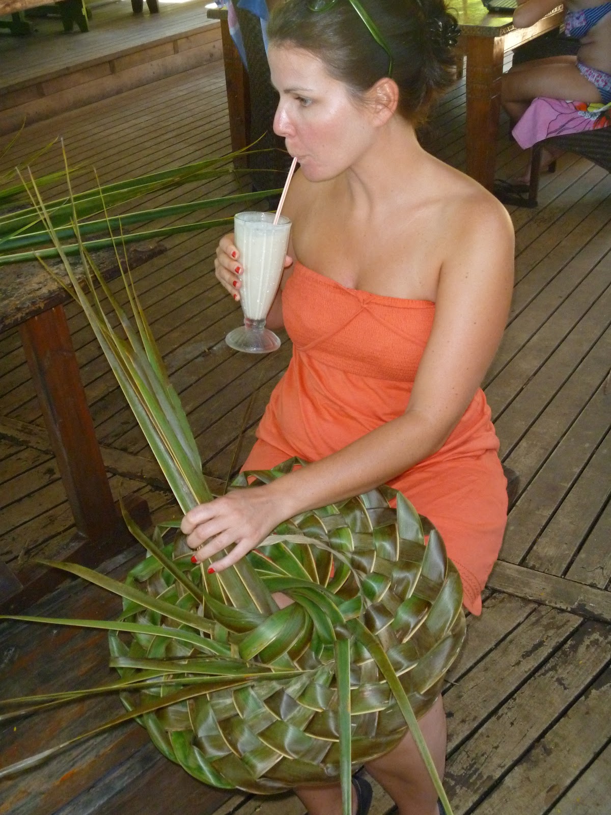
Back in Christchurch and back to reality... the following morning it was apparent that we had been unable to fix the water 'issue' and to make matters worse the primary battery for the engine had somehow gone flat.  Luckily we were at the holiday camp and could get Marv II jump started, however it proved to be the final nail in the coffin.  A lack of power steering, leaking sink, an annoyingly different layout and now a flat battery.  Two days, two nights and only 15km on the clock and we were both crying out to be reunited with our beloved and original Marv.  Off to the depot we went, and fortunately Marv was still there.  The guy at the depot (which is essentially a field on the side of a guys house) sent our original Marv down to the mechanics for a check over and while we waited he showed us round the grounds of his house.  This guy, Bryan, has a large plot of land where he has all manner of fruit and nuts growing in orchards, a large pond, and of course a field of sheep (this is New Zealand after all).  When Marv came back from the garage he had been given the all clear, the problem which had become apparent was fixed (needless to say it was missed by the mechanic at Fox).  We set about moving our stuff back into Marvin and we're even given a big bag of walnuts and hazlenuts as well as some fresh apples before setting off.  The Marvelous Marv was back with us and back on the road.

This left us just the afternoon to have a good look around Christchurch, the South Islands biggest (possibly only real) city, and home to nearly half of all South Islanders.  Luckily the weather was holding up so we could have lunch in the park and a stroll through the stunning botanic gardens.  We also had a nose round the massive Canterbury Museum, of particular interest was all the history and detail of the devastating earthquake that hit in February 2011.  The broken bell and crucifix from the cathedral lie in the museum alongside alarming footage captured from civilians and security cameras.  Christchurch city centre is still a write-off with the central district still blocked off 14 months on while future planning takes place. In its place they have erected a pop up shopping centre made from shipping containers just south of the old city centre.  Walking around the edges of the Red Zone feels a little post-apolocalyptic as you can see through the wire fencing into a deserted and in parts crumbling city. 


Hopefully in the years to come Christchurch will redevelop its city centre, but the way in which they are recovering and the speed of the changes seems to be a controversial issue amongst the local population.

Monday 9 April 2012

In search of Geraldine

Don't be fooled this blog entry is not about Geraldine Place, but the equally wonderful Geraldine THE Place.  Geraldine, in the heartland of the Canterbury Plains is the fresh fruit and produce capital of New Zealand.  We first however had to make our way north east several hundred kilometers from Queenstown.

Hoping to get a relatively early start on the road we were waylaid briefly as Marvin decided he like Queenstown so much he didn't want to leave.  After an hour or so we finally got Marv up and running and were on our way.  Once on the move we headed back past the Kawarua Bungee Bridge and through the town of Cromwell, apparently the town furthest from a coast in New Zealand.  We continued on our way through the Central Otago wine valley and vineyards to the top and over the otherside of the Lind Pass.


That afternoon we arrived at Lake Pukaki.  A huge brilliantly turquoise glacier-fed lake.  This route brough us up the east side of the Southern Alps and we were now the otherside of Mt Cook from when we had been at the Fox and Franz Josef Glaciers.  Evidently in the time we had been in the southern part of the island the freeze had started as 3,000m up on Mt Cook we could see a lot more snow than the week before.


We found a free campsite on the edge of the lake set amongst a pine forest which offered some fantastic views of the now heavily snow capped Mt Cook.  New Zealand prohibited 'Freedom Camping' in September 2011 due to waste products and inconsiderations of certain campers.  Freedom Camping is stopping overnight in a non campsite location if you are not self-contained, ie. no toilet on board.  We always stay in designated campsites, although these free ones often have just a long drop toilet and not much else!  These campsites or 'reserves' are often on the edge of a lake/river/beach, so often offer some great views.  Due to the banning of the Freedom Camping, district councils are putting more free campsites in place, but you need to look for them or ask at the local visitors centre or you might never find them.


The clocks have just rolled back an hour for Autumn so we woken nice and early by the early bright sunshine.  Daylight hours are around 7am-7pm now, with it being pitch black by 7.15pm.  This means its a tad easier getting up in the morning (although still cold) but means we ideally need to be located by 6.30pm to make sure we're not driving around aimlessly in the dark of an evening.  So woken by a new Autumn sun that morning we dragged ourselves away from the lake and the morning views of Mt Cook.... the evening views were better anyway.  We carried on up the road till we arrived at our next brief stop, Lake Tekapo.  A lake of a similiar vain to the previous with a shimmering turquoise colour.  What puts this lake on the map is its small chapel, 'The Church of the Good Shepherd'.  The chapel is on the southern shore of the lake and the window behind the altar opens out to stunning views of the lake and scenery behind.  At 700m above sea level the area around Lake Tekapo is billed as having the clearest air in the Southern Hemisphere.  It looks pretty clear during the day but a night you can really appreciate it as the sky is covered with stars and the milky way can be seen as clear anything.


From Lake Tekapo we made our way through the very small town of Fairlie, before arriving fairly quickly to Geraldine.  The locals here must have thought we were on some mad drugs or something as we ran around laughing and taking pictures of everything that said 'Geraldine'.  This ultimately was a lot;  the butchers, bakers, library, cinema, school even police station!  After the initial excitment had died down we had a look around and discovered to our (low budget) benefit that there were plenty of produce stores open for free tasters etc.  We headed first for Barkers for a whole host of jams, chutneys, pickles and juices before taking a stroll down the road to Geraldine cheese shop for a savoury treat.  Last on the list was a small store called Prenzel of Geraldine where we spent half hour talking to the shop owner about our travels around New Zealand and she told us all about her family who had most moved to Oz.  Prenzels had a great selection of sauces as well liquors (a bit early for), but we ended up buying just some cheese and walnut paste, but only after Adam had finished off nearly a whole jar of assorted pickles and chutneys.


We found another free campsite just outside of Geraldine on the edge of the small village of Arundel to spend the night.  The following morning was time to tackle the Route 72, the South Islands 'Inland Scenic Route' up to Christchurch.

Wednesday 4 April 2012

Bungeee...

The Kawarau Bridge Bungee Jump in Queenstown.  If the embeded video doesn't work try the manual youtube link below....


Milford Sound

The hardest thing about this blog update is quite simply selecting just a choosen few photos to put on here from the three hundred plus taken in just a twelve hour period.

Milford Sound lies 100km West of Queenstown but is a good 600km horseshoe shaped round trip.  The top right of the horseshoe is Queenstown and Milford Sound lies at the top left on the Tasman coast.  The sprawling mass of the Southern Alps prohibits any more direct approach.  Rather than venturing all that way out there on our own we decided to do the day trip from Queenstown.

Setting off at 6.45am we got on the coach whilst it was still dark and very very cold.  The coach made its way around Lake Wakatipu and along the base of The Remarkables.  As the first signs of daylight were appearing we could start to see the outline of the dominating mountain range.  As the early morning wore on more and more light appeared but the visibility was often kept low by the fog.  At some stages it felt like travelling through a cloud, it was a welcome relief not to have the responsibility of driving on these roads.  The further we went the more the sun started to burn off the fog and the more we could see, although it was still feeling pretty nippy.  After a few hours we arrived at the pleasant lakeside town of Te Anau (bottom left of the horseshoe), we were about two thirds of the way there, but had the slowest third to go as we needed to go up and over the mountains and in one case straight through.

So far the scenery had been quite farmland based, (and i think a few people slept through it), but after our mid morning coffee break in Te Anau things were starting to heat up as we set off on the Milford Road.  After a short while we pulled up in a valley at the base of a small mountain range where the fog had all but burnt off leaving just a thin layer lining the base of the mountains.  Fog itself is often tainted as an annoyance, but in this instance it has never looked so good.  A little further down the road we arrived at the very aptly named 'Mirror Lakes' which gave some incredible views of the surrounding mountains and vegetation.  Our final stop before Milford Sound was The Chasm, a large waterfall that had blasted the rock in its way to create its own path through the forest leaving some very interestingly shaped rock formations in its wake.  The last stage of the coach journey was through the mountain as we headed through the Homer tunnel, a single lane 1.5km long gradient tunnel that had taken over 20 years of blasting through solid rock to create.  As its one-way and 1.5km in length you need to time your journey right otherwise you can be waiting up to ten minutes for the green light!


Shortly after midday we arrived at Milford Lodge, a quick comfort break and a chance to stretch the legs before we were whisked onto our cruise boat, The Lady Bowen, for a two and half hour cruise around the Sound.  The Sound itself is the result of a long retreated Glacier but it reaches all the way out the Tasman Sea so is actually full of salt water.  This coupled with the depth, often over 200m, makes a great retreat from the Ocean for sealife including Fur Seals and Dolphins, of the former we saw plenty but unfortunately no dolphins.  On the cruise we passed plenty of waterfalls, some of which are only present after several days of rain, and all manner of rock formations.  The Sound is such a vast expanse of space that you need the two hours to appreciate it fully.  The cliffs mainly rise vertically out of the water for half a kilometer or more, and what can look like a small waterfall on the otherside of the Sound can be the size of a 50 storey building when you get up close.  Its hard to describe in words (and to do justice) to the beauty of Milford Sound.  The feeling of euphoria due to the epic expanse of the openess of the perfectly still water combined with the conflicting constrictions of the mountains rising vertically from them is almost surreal at times.


 Weather conditions were good for us, in what can be a very pot luck location.  As the cruise wore on some of the bigger clouds dispersed and we had fantastic blue skies and sunshine emenating from behind the remaining scattered clouds.  With conditions good we were able to get out into the Tasman and view the entrance to the Sound from the Sea.  The same as Captain Cook would of done some 250 years previous, Cook however misinterpreted the entrance as just a small bay and Milford Sound remained hidden from European eyes for 100 years.


After a spot of lunch on the boat we headed back to our coach for a long trip back to Queenstown.  At the end of the day it felt like a long coach journey back, but still the views arriving back to Queenstown with the sun setting behind the mountains makes it feel like you've had a full day of sightseeing rather than just the coach being 'transportation'.


Due to time constraints and the distance to Milford Sound we were unsure at first if we were going to see it.  However choosing the day trip from Queenstown made it feasible and extremely enjoyable. We would definitely recommend to include Milford Sounds on the list for any visit to the South Island!